NOAA predicts below‑average 2026 Atlantic hurricane season as El Niño strengthens, but risks remain
NOAA forecasts a below‑normal 2026 Atlantic hurricane season, citing a developing El Niño expected to suppress storms despite warmer Atlantic waters. Officials stress that a quieter season does not eliminate the threat of major landfalling storms—prepare now.
Key takeaways
- NOAA outlook: 8–14 named storms, 3–6 hurricanes, 1–3 major hurricanes (NOAA briefing).
- Primary driver: A developing El Niño is expected to outweigh warm Atlantic sea‑surface temperatures and reduce activity.
- Risk reminder: Below‑average seasons can still produce destructive, landfalling storms—prepare and stay informed.
NOAA’s forecast: numbers and reasoning
NOAA’s 2026 Atlantic hurricane season outlook calls for 8 to 14 named storms, 3 to 6 hurricanes, and 1 to 3 major (Category 3+) hurricanes — mostly below the 1991–2020 averages of 14 named storms, seven hurricanes and three major hurricanes (NOAA briefing; WUFT reporting).
Forecasters assign roughly 55–70% odds that the season will be below normal. Two competing influences are cited: slightly warmer‑than‑average Atlantic sea surface temperatures (which favor more storms) and a developing El Niño (which tends to suppress Atlantic activity). NOAA projects the El Niño signal will likely dominate (NOAA briefing).
How El Niño affects Atlantic hurricanes
El Niño is a phase of the El Niño‑Southern Oscillation (ENSO) marked by warmer-than-average water in the central and eastern equatorial Pacific. ENSO shifts winds and rainfall patterns globally (ENSO explainer).
During El Niño, stronger upper‑level westerly winds cross the tropical Atlantic, increasing vertical wind shear — the change in wind speed or direction with height. Higher shear can tilt and disrupt developing tropical storms, reducing their formation and intensification. El Niño also redirects rising air and thunderstorm activity toward the Pacific, depriving the Atlantic of fuel for storms (NWS explainer; NOAA briefing).
Stronger El Niño events generally produce clearer teleconnections, but the exact regional impacts and timing remain uncertain. A so‑called “Super El Niño” raises the odds of stronger effects, yet outcomes vary by season and location (CPC discussion; ENSO explainer).
What NOAA scientists said
In the public briefing and Q&A, NOAA officials emphasized that a developing El Niño is the primary driver of the below‑average Atlantic outlook. Internal guidance cited about a 40% chance that El Niño reaches strong or very strong levels this year, bolstering confidence that El Niño will “win” over warm Atlantic waters (NOAA briefing).
“El Niño will ‘win’ over warm Atlantic waters,” NOAA officials said, noting that seasonal totals do not predict landfalls and reminding the public to prepare.
Officials also noted the forecast range is wide due to model and observational uncertainty, especially around the timing of El Niño’s full development. They reiterated that even quiet seasons can produce catastrophic storms and urged continued preparedness (NOAA briefing).
Comparison with Colorado State University
Colorado State University’s April outlook aligns with NOAA’s quieter‑season view, calling for about 13 named storms, 6 hurricanes, and 2 major hurricanes. CSU researchers attributed the subdued outlook largely to the expected Super El Niño (WUFT reporting).
Both NOAA and CSU place El Niño at the center of their reasoning; their numbers differ slightly but fall in the same general range, reinforcing the case for below‑average Atlantic activity if El Niño strengthens as expected.
Season timing and why timing matters
Climatology shows the first named storm often forms near June 20 and the first hurricane near August 11, with the season peaking in mid‑August through late September. Whether El Niño is fully in place by mid‑summer matters: an early, strong El Niño could suppress core‑season (August–October) activity, while a later development may allow near‑normal early‑season activity (ENSO explainer; WUFT reporting).
Risk perspective: below average does not mean safe
A below‑average season is not a safe season. NOAA and local meteorologists warned that a single major storm can cause severe harm. Seasonal forecasts indicate basin activity, not who will be hit. Residents should maintain preparedness—emergency kits, evacuation plans and attention to individual storm forecasts (NOAA briefing; NWS explainer).
El Niño and Pacific activity
While El Niño tends to quiet the Atlantic, it typically boosts activity in the Eastern and Central Pacific. NOAA expects an above‑normal Eastern Pacific season, forecasting 15–22 named storms, 9–14 hurricanes and 5–9 major hurricanes, plus 5–13 tropical cyclones in the Central Pacific (NOAA briefing).
This shift matters for Pacific islands, Mexico and parts of the U.S. West Coast in some years, with implications for rainfall, surf and atmospheric rivers.
Implications for California
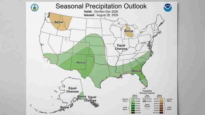
Economic and infrastructure impact: El Niño can increase the risk of stronger Eastern/Central Pacific storms and atmospheric rivers, which bring heavy rain and coastal surf. Inspect and repair roads, levees and storm drains; pre‑position resources where appropriate.
Insurance and homes: Homeowners and businesses should review policies and flood coverage now. Heavy Pacific storms and atmospheric rivers can cause flooding and landslides—adequate coverage matters.
Public safety and preparedness: Maintain emergency kits, update evacuation plans for flood or landslide zones, and monitor the National Weather Service and local emergency officials. Even a single high‑impact storm can create sudden hazards.
State planning and federal cooperation: Coordinate with federal partners for pre‑positioning and rapid response. Prioritize targeted infrastructure investments and transparent resilience spending.
Business and supply chains: Ports and freight corridors are vulnerable; companies should assess exposure and prepare contingency plans for shipments and employee safety during major Pacific storms.
Timing matters: if El Niño strengthens early, expect higher near‑term risk for a wetter winter; if it strengthens later, impacts could be delayed or different. Monitor NOAA and local NWS updates (NOAA briefing; ENSO explainer).
Sources and further reading
- NOAA 2026 seasonal briefing (video)
- WUFT reporting on NOAA outlook and CSU comparison
- ENSO explainer, climate.gov
- NWS El Niño and La Niña overview
- CPC discussion of ENSO strength and impacts
For regular updates on the 2026 Atlantic hurricane season, NOAA hurricane forecasts and evolving El Niño conditions, check NOAA and your local National Weather Service office.